
Autodesk Civil 3D
Civil 3D: Civil Infrastructure Design and Documentation Software
Civil 3D® civil engineering design software supports BIM (Building Information Modeling) with integrated features to improve drafting, design, and construction documentation.
Conduct grading design studies based on project constraints. Grading Optimization is available in Civil 3D only as part of the Architecture, Engineering & Construction Collection.
- Automate time-consuming grading tasks.
- Explore alternatives to achieve an optimal grading solution.
- Return the selected grading proposal to Civil 3D for detailed design.
Invest in Advanced Design: Buy a Civil 3D License
Get your hands on a Civil 3D license today. Explore our range of competitive prices for Civil 3D licenses, designed to match your budget. Enhance your civil engineering projects with the dynamic capabilities of Civil 3D. Choose our cost-effective options and harness the full power of Civil 3D for your design and infrastructure endeavors.
What’s New in Civil 3D 2027?
Civil 3D has long stood as the preferred design tool for civil engineers. However, dealing with intricate projects containing sizable design files can still result in significant time investments when opening, editing, and saving.
Autodesk has diligently worked to enhance the speed of Civil 3D operations, aiming to empower users to complete their projects promptly and within budget constraints, particularly for routine tasks.
- Coordinate system modernization: improved the UI, making it more intuitive and easier to use
- Multi-baseline corridor setup: with this improvement, designers don’t have to wade through the “pick and click” process when setting up a corridor model that has multiple baselines. With a single click you can now set up these elements in one go.
- MMS file saving: now, MMS files are only saved when the surface is modified. This one change will reduce Autodesk Construction Cloud (ACC) file processing time dramatically.
- Esri ArcGIS® basemaps: to help designers and engineers visualize terrain, streets, and structures, Autodesk has added five Esri basemaps to the Civil 3D ribbon under the Geolocation tab:
1. Open streets
2. Esri streets
3. High-resolution satellite and aerial imagery
4. Light and dark grey monochrome maps

Civil 3D overview (video: 2:18 min.)
Civil 3D Highlighted Features
Collaboration for Civil 3D
Securely access Civil 3D files, data shortcuts, and xrefs from multiple locations and companies, all in a common data environment.
Connector for ArcGIS
Streamline the Flow of data between ArcGIS and Civil 3D. Access the latest data and keep features information up to date.
Dynamo for Civil 3D
Use the Dynamo visual scripting environment to develop routines that automate repetitive design tasks and expedites workflows.
Bridge design
Coordinate workflows more efficiently across the various disciplines working on complex bridge design projects.
Pressure network
Use enhanced tools for more efficient pressure pipe network layout and design.
New transit and rail design features
Expanded toolkit for transit and rail design including spirals, dynamic alignments, profiles, and superelevation design.
Use Civil 3D with other Autodesk Software
Civil 3D + InfraWorks + Revit
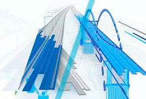
Integrated bridge analysis and design.
(video: 2:44 min.)

Civil 3D + ReCap Pro
Further enhance 3D modeling and designing in Civil 3D. (video: 2 min.)

Civil 3D + InfraWorks + Revit +Navisworks
Improve site and building design coordination with shared coordinate systems. (video: 2:13 min.)
MicroCAD Productivity Tools for Autodesk Civil 3D

MicroCAD Civil 3D Productivity Tools is a set of essential productivity plug-ins that will make your work in Civil 3D fast, easy and efficient. These tools will dramatically reduce the number of tedious tasks and help you focus on your engineering challenges.
Streamline your everyday tasks, Reduce the amount of tedious work, Do things that are not possible with out-of-the-box Civil 3D, Become more productive.
Frequently Asked Questions
What is Autodesk Civil 3D used for?
Civil 3D is a civil engineering design and documentation platform built for infrastructure projects such as roads and highways, land development, subdivisions, drainage and stormwater systems, pressure networks, rail corridors and bridges. Its dynamic model links surfaces, alignments, profiles and corridors, so a change in the design updates the associated plans, profiles and quantities automatically.
For engineering firms and public agencies, that dynamic relationship is the difference between redrawing sheets and simply reviewing them. It also supports BIM for infrastructure, allowing your civil data to flow into coordination, visualization and construction workflows instead of staying locked in isolated drawings.
What is new in Civil 3D 2027?
The 2027 release focuses heavily on performance and usability for large, complex design files, which is exactly where teams lose the most billable hours. Key improvements include:
Coordinate system modernization, with a more intuitive and easier to navigate interface.
Multi-baseline corridor setup, which replaces the repetitive pick and click process with a single click configuration for corridor models that use multiple baselines.
MMS file saving behavior, where MMS files are now saved only when the surface is modified, dramatically reducing Autodesk Construction Cloud file processing time.
Esri ArcGIS basemaps, with five basemaps added directly to the Geolocation tab of the ribbon: open streets, Esri streets, high resolution satellite and aerial imagery, and light and dark grey monochrome maps.
If your team routinely waits on file opening, editing and saving times, these updates are the strongest argument for keeping your Civil 3D license current.
How do I buy a Civil 3D license, and what does it cost?
You can purchase a Civil 3D license directly through MicroCAD as an authorized Autodesk partner, with competitive pricing options designed to match different budgets and team sizes. Licensing is subscription based, and the right configuration depends on how many users need full access, how often they use the software and whether your workflows require additional Autodesk products.
Working with a partner instead of buying in isolation gives you license optimization, renewal management and direct access to consultants who know how civil teams actually use the software. Many organizations discover they are paying for seats they do not use, or missing entitlements they already own.
Is Civil 3D available in the AEC Collection, and what does that add?
Grading Optimization lets you conduct grading design studies based on real project constraints. With it, your team can automate time consuming grading tasks, explore multiple alternatives to reach an optimal grading solution, and return the selected proposal back into Civil 3D for detailed design. For land development and site work, this alone can justify the collection over a standalone seat.
Can multiple offices and companies collaborate on the same Civil 3D project?
Yes, through Collaboration for Civil 3D. It allows teams to securely access Civil 3D files, data shortcuts and external references from multiple locations and multiple companies within a common data environment.
This is the practical answer for firms running distributed design teams, joint ventures or projects with subconsultants. Instead of emailing files or maintaining fragile shared drives, everyone works against a controlled, current dataset in the cloud. MicroCAD helps define the folder structure, permissions and data shortcut strategy before rollout, which is where most cloud deployments succeed or fail.
Does Civil 3D integrate with GIS and automation tools?
It does, in two important ways.
The Connector for ArcGIS streamlines the flow of data between ArcGIS and Civil 3D, so your team can access current geospatial data and keep feature information up to date without manual re-import cycles. This matters for agencies and utility projects where GIS is the system of record.
Dynamo for Civil 3D provides a visual scripting environment for building routines that automate repetitive design tasks. Teams commonly use it for batch labeling, standardized styles, data extraction and reporting, turning hours of manual work into a reusable script.
What are MicroCAD Productivity Tools for Civil 3D?
The MicroCAD Civil 3D Productivity Tools are a set of plug-ins developed specifically to make daily work in Civil 3D faster, easier and more efficient. They reduce the volume of tedious, repetitive tasks so engineers can focus on solving engineering problems instead of managing software behavior.
With these Civil 3D productivity tools, teams can streamline everyday tasks, cut down manual work, and perform actions that are not possible with out of the box Civil 3D. For firms billing
How long does implementation take, and is training included?
Timelines depend on scope. A straightforward license deployment for a small team can be completed quickly, while a full BIM and cloud adoption program involving standards, templates, data shortcuts and Autodesk Construction Cloud integration is usually phased over several weeks.
MicroCAD supports the full lifecycle: software implementation, role based training for engineers, designers and CAD managers, and ongoing technical support once the team is working in production. Our consultative approach focuses on adoption, not just installation, because software that sits unused delivers no return.